The rivers + people planning in Kenya
Under the Realising Urban Nature-based Solutions (r u NbS) programme, alongside co-funding from several complementary initiatives, the Rivers + People (R+P) planning process has been implemented in Mukuru and Kibera in Nairobi, as well as in Dallas and Embu Town. In each location, the process was tailored to the local environmental, spatial, and governance context, whether along active river corridors or in densely built urban areas grappling with drainage and flood risks.
The following section outlines the core principles and step-by-step methodology of the R+P process, demonstrating how it enables the co-creation of socially inclusive and ecologically resilient neighbourhood plans.

R+P planning principles
The Rivers + People (R+P) approach is grounded in a set of guiding principles that combine ecological restoration with community leadership, ensuring that planning is inclusive, context-sensitive, and resilient to climate risks.

Community-led, Ecologically Attuned Development
Planning is anchored in local knowledge and priorities while restoring or enhancing ecological functions.

Natural Systems as Structure
Rivers, drains, or green corridors are used as key organising features for the plan.

Integration of Green-Grey Infrastructure
Solutions blend nature-based and engineered systems to address stormwater, flooding, and infrastructure challenges.

Spatial Integration
New interventions are embedded within the existing urban fabric and settlement patterns.

Built on Existing Initiatives
Local initiatives and informal systems are recognised as foundations for scalable, sustainable development.

Connectivity and Inclusion
The approach improves links between new and existing infrastructure, including roads, green spaces, and drainage systems.

Participatory Risk Mapping
Flood modelling and hazard mapping are used to foster consensus and identify priority action areas.

Ecological and Human Rights Focus
The process promotes ecological health and ensures dignity, access, and equity for all residents.
Key Components of the R+P Planning Process
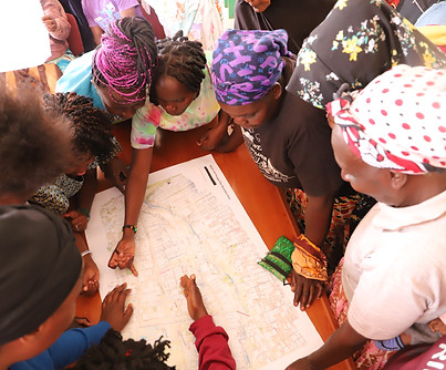
The Rivers + People (R+P) Planning Process follows a step-by-step methodology designed to centre local knowledge, enable inclusive decision-making, and deliver actionable neighbourhood plans. Each phase builds on the last, moving from analysis to visioning, and ultimately to co-developed solutions that reflect both community priorities and environmental realities.


Adapting the R+P Planning Process in Embu: The Dallas Green Infrastructure Plan
As an application of the Rivers + People (R+P) planning principles in a secondary city context, the Dallas ASILI (Adaptation Solutions, Inclusive Locally-led Infrastructures) project in Dallas informal settlement, Embu County, demonstrates how the R+P approach can be adapted and scaled in areas without a central river system, but still facing acute water-related and environmental challenges.
Led by KDI in partnership with the Embu County Government, and supported by the Covenant of Mayors in Sub-Saharan Africa (CoMSSA), the project applied the full R+P planning process to co-develop a Green Infrastructure Plan for the settlement. The initiative was funded by GIZ and co-funded under the r-u-NbS programme with support from SwedBio. While the foundational R+P components—such as community mobilisation, participatory mapping, collaborative visioning, and co-design of interventions—remained central, the Dallas process featured a stronger involvement of government stakeholders throughout all stages.

This more institutionalised collaboration helped align the community-generated plan with county-level urban resilience goals, ensuring that the proposed green infrastructure solutions, such as natural drainage paths, rehabilitated water assets, and multifunctional public spaces, could be integrated into broader development frameworks.
The process was further enriched by a series of capacity-building and public awareness activities, including climate change workshops, neighbourhood clean-up events, and stakeholder dialogues. These not only fostered community ownership and technical know-how but also strengthened cross-sectoral relationships, crucial for long-term sustainability and maintenance of the interventions.
Ultimately, the Dallas Green Infrastructure Plan is a locally anchored, government-supported outcome of the R+P process. It demonstrates how nature-based solutions can be co-produced in informal settlements in smaller urban centres, creating a model for scalable, climate-resilient planning that is grounded in both community priorities and public policy frameworks.
